

Brandywine Falls: before you go
A 70-metre waterfall, a platform on the canyon rim, and a short walk from the car. Here's what BC Parks says about access, the gate, the trails, and staying out of the canyon.
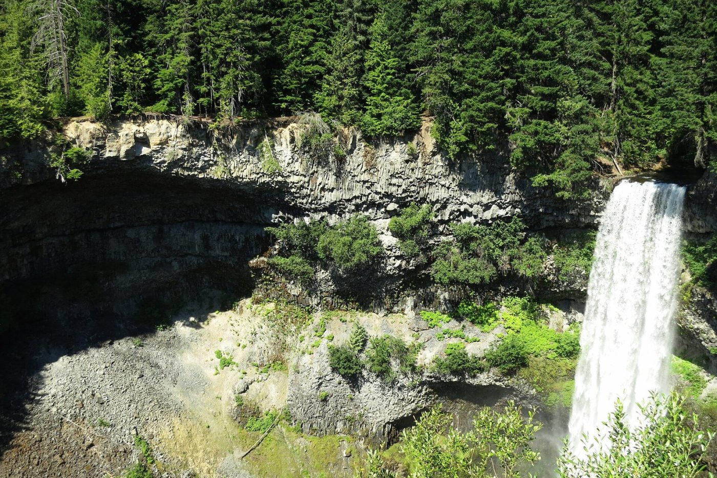
Brandywine Falls is the easiest big payoff on the 99: a 70-metre waterfall dropping into a basalt canyon, reached by a short forest walk from the parking lot. That ease is also why people get into trouble here. Here’s what BC Parks says you need to know before you pull in.
Getting there
The park sits off Highway 99, 47 km north of Squamish according to BC Parks. The province’s Sea-to-Sky exit list puts the park access at km 84.8 north of Horseshoe Bay, just shy of Whistler’s southern boundary at km 85.2. Coming from Squamish, that’s the turn after the Brandywine railway crossing.
The gate and parking
The day-use gate keeps seasonal hours. BC Parks lists:
- May 1 to June 14: 8 a.m. to 9 p.m.
- June 15 to Sept. 14: 8 a.m. to 10 p.m.
- Sept. 15 to Oct. 31: 8 a.m. to 8 p.m.
Outside those dates, the gate is closed and the park is walk-in only. Don’t solve that by parking on the shoulder. BC Parks asks drivers to keep the highway clear for safety and winter maintenance and warns that illegally parked vehicles may be towed at the owner’s expense. A current park advisory adds the obvious: don’t leave your car in front of the gate or anywhere signed no parking. If you’re coming late in the day this month, note the 8 p.m. close.
The walk to the falls
The Brandywine Falls Trail is the one most people want. BC Parks times it at 10 to 20 minutes one way. You cross a covered footbridge over Brandywine Creek, go through the forest, and cross the Canadian National rail line to reach the viewing platform. A short path continues to a second viewpoint of the falls and a third looking over Daisy Lake toward the Black Tusk. Treat the rail crossing like a rail crossing: look, listen, then go.
The platform was finished in spring 2006 and sits on the edge of a volcanic escarpment. If you don’t like heights, you’ll know it.
Stay out of the canyon
This is the part to read twice. BC Parks says there is no access to the lower falls area and calls the canyon extremely unsafe, citing unstable slopes and falling rock. Visitors are told to stay on designated trails and viewpoints, behind the fences, and away from the river’s edge. Photos taken from the bottom of the falls circulate online. That doesn’t make it a trail, and Corridor 99 won’t run them.
Other trails in the park
- Swim Lake Trail: a short, rough branch off the main trail just before the railway crossing, with one steep pitch, ending at a small lake. No beach, dock, or lifeguard.
- Lava Lake Trail: 2.7 km from the footbridge, starting with a short, steep hill and then running on gentle ground through pine forest and small lakes to the north end of the park.
- Sea to Sky Trail: a 1.5 km section heads northeast from the main trail, after the tracks, to the Whistler Bungee bridge over the Cheakamus River. BC Parks describes it as packed gravel with mostly gentle grades and a few steep pitches and tight corners for bikes. It’s part of the 180 km route the Squamish-Lillooet Regional District describes from the Squamish waterfront to D’Arcy. See our Sea to Sky Trail guide for the rest of it.
Bikes, dogs, fires and water
- Bikes: stay on roadways, and wear a helmet; BC Parks notes helmets are mandatory in B.C. E-bikes aren’t allowed on the park’s trails, only on park roads and areas where motorized use is permitted.
- Dogs: on leash at all times, not in beach areas or buildings, and you pick up after them.
- Fires: campfires aren’t permitted.
- Water: there’s no potable water. Bring your own.
The day-use area has six picnic tables and pit toilets, per BC Parks.
Fall and winter
BC Parks says the park’s trails aren’t maintained in winter, and after Oct. 31 you’re on foot from the highway side of a closed gate. Check the park page for advisories before you leave, and DriveBC for the 99. Winter tires are required on this stretch of highway from Oct. 1 to March 31; our winter tire explainer has the details.
Why it’s called Brandywine
BC Parks offers one possible explanation: two surveyors for the Howe Sound and Northern Railway, Jack Nelson and Bob Mollison, bet a bottle of brandy on who could better guess the height of the falls. A chain settled it, Mollison won, and Nelson named the falls. The park itself tripled in size in 2010 to take in habitat for red-legged frogs, a blue-listed species in B.C., so keep to the trail around the ponds too.
Who to call
The park is run by Sea to Sky Park Services Ltd., reachable at 1-604-986-9371 or [email protected], according to BC Parks.
Sources
- BC Parks: Location, falls height, viewing platform, trail descriptions and times, canyon safety, gate hours, off-season walk-in, towing, pets, bikes and e-bikes, fires, water, facilities, winter maintenance, name history, 2010 expansion, operator contact
- BC Parks: Parking advisory (gate and no-parking areas)
- B.C. Ministry of Transportation and Transit: Km markers: Brandywine railway crossing 84.5, park access 84.8, Whistler south boundary 85.2
- Squamish-Lillooet Regional District: Sea to Sky Trail: 180 km from the Squamish waterfront to D'Arcy
- Province of British Columbia: Highway 99 winter tire period Oct. 1 to March 31
- Wikimedia Commons: Photo licence and credit
.jpg)